Select a region


A local tour guide has been tracing the route of the Second World War railway.
The remains of German war fortifications in Guernsey are mostly very obvious. What are less visible are reminders and remains of the railway constructed by occupying forces that ran around the majority of the west and north coast and supplied the various bunkers, machine gun posts and anti-aircraft positions.
Now, however, local tour guide and history enthusiast Tim Osborne is bringing the railway back into view with a series of online posts that are quickly gaining in popularity. His findings, photos and explanations have established a firm following online, and he is planning to publish a book and even make a short film.
Mr Osborne’s interest in the island’s wartime past grew through being in Festung Guernsey, the local WWII society that excavates and maintains bunkers and other Occupation constructions. He later learned of the railway from Frank Wilson’s book “Railways In Guernsey”, and that sparked a real interest.
“Frank Wilson’s guide was the basis which I tried to follow," he told Express. "Using that, Digimap’s excellent 1945 online map and the knowledge I already had, I have managed to pinpoint the route.”
Pictured: Tim Osborne's initial work on the railway started eight years ago, but it is only now that the project is accelerating.
“Lockdown has given me the time to do this. My first post around Le Catioroc was so popular that I thought I would continue. Most homeowners have been happy for me to take photos, and it’s all come together well.
“People are interested in history. Let’s talk about the Occupation – people need facts, not fiction, and that way we can all learn from history together.”
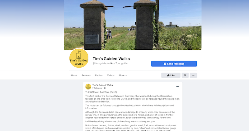
Pictured: Tim Osborne's Facebook page details the many sections of the railway that he has covered so far.
He has so far produced a series of Facebook posts on his page, Tim’s Guided Walks. Section One covers L’Erée to Perelle, with the rest so far tracing the route clockwise around to the Bridge.
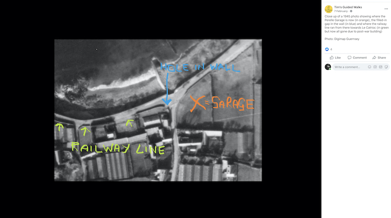
“I’ve just finished looking at North Side, where there are still some rails in situ at Sarnia Oil. L’Islet was like Clapham Junction, where all the servicing yards were. But they're all gone now. I’ve overlaid the Word WarTwo aerial photo that Digimap has online, and I’m pretty confident that I’m within a few feet of the route of the railway.”
Usually a pilot for Aurigny, Mr Osborne has also been a member of the Bailiwick of Guernsey Guild of Accredited Guides since 2013. The list of his interests and the tours he runs can be found online.
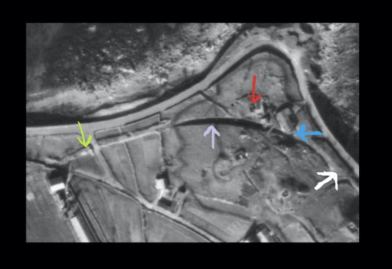
Pictured top: The route of the WWII railway as it runs past Le Catioroc at Perelle.


Comments
Comments on this story express the views of the commentator only, not Bailiwick Publishing. We are unable to guarantee the accuracy of any of those comments.