

This week's weather is predicted to get wild with a visit from Storm Ciaran as some forecasters say the Channel Islands will take the "brunt" of it.
From Wednesday the winds are forecast to build to 85mph by Thursday, before receding and then growing in strength again on Saturday.
From today, the forecast grows increasingly windy with west to southwesterly gusts up to strong F6, while on Wednesday the winds are forecast to reach F7 before "decreasing westerly". On Thursday the gusts could reach storm F10, with gusts to 85mph, along with thundery rain showers.
Regardless of any further N/S shifts, it does look as though our friends over at the Channel Isles will take the brunt of strongest gusts from Storm Ciarán - here it is highly possible that 90-100mph gusts could be reached. pic.twitter.com/CDXj2PhGsh
— UK Weather Updates (@UKWX_) October 30, 2023
The strong winds will coincide with high tides of 9.14m and 8.72m at 08:20 and 20:40 on Wednesday, with them dropping to heights of 8.6m and 8.06m at 08:50 and 21:10 on Thursday when the winds will be at their strongest.
Forecasters have suggested that problems may occur when the winds peak, and combine with periods of low pressure.
They've said the wave heights could reach 8m at peak times meaning sand and rocks will be thrown over the sea walls with the water.
A group of amateur forecasters who manage the 'Guernsey Weather Enthusiasts' page on Facebook are predicting "Ciaran's effects will start for us with the winds picking up after lunch (on Wednesday) and becoming strong at tea time in a southerly direction.
"A heavy band of rain will move in during the evening with some very heavy rain overnight into Thursday."
Acknowledging that "things can change" the group of amateur experts (who have asked to remain anonymous) said they predict that the winds overnight Wednesday into Thursday will "strengthen further as the rain clears through and back westerly as day breaks on Thursday".
The Guernsey Weather Enthusiasts said that the wind directions may vary but "whatever the track we'll see severe gale force winds regardless".
They added that while many people may be dismissive of the weather warnings issued, "the world has seen some crazy weather events this year and what's to say we're immune from it? This could be that once in a generation event."
Occurring just over 36 years on from the Great Storm of 1987, which was infamously dismissed ahead of landing by BBC Weather Presenter Michael Fish, the anonymous amateurs behind the Guernsey Weather Enthusiasts said they would rather say something and be wrong than say nothing.
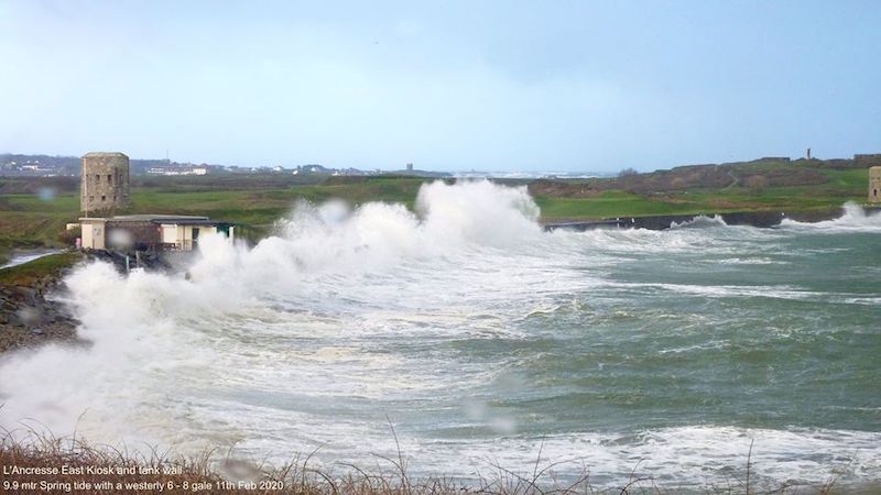
Pictured top: Image of L'ancresse East wall during a 9.9m spring tide, F6-8 gales, February 2020 (Gary Blanchford).
STORM CIARAN: Condor sailings affected
Comments
Comments on this story express the views of the commentator only, not Bailiwick Publishing. We are unable to guarantee the accuracy of any of those comments.