
A draft development framework has been released for a parcel of land in the Vale, as the States also announced the approval of another framework for land in St Peter Port.
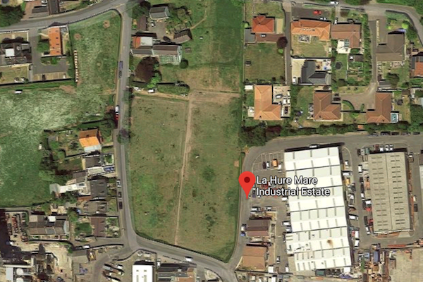
The land in the Vale is behind the power station and near the site of States Works along La Hure Mare road, while the land in town is off Route Isabelle, near the Rohais.
Up to 38 residential properties could be built on the land to the South East of Le Maresquet Farm in the Vale if the draft development framework is approved, based on a guideline of possible density of up to 55 dwellings per hectare.
The land in question is 0.7 hectares or 4.3 vergees.
The draft development framework can be seen on the States of Guernsey website here or copies can be viewed at Sir Charles Frossard House. Comments must be submitted by 1 October.

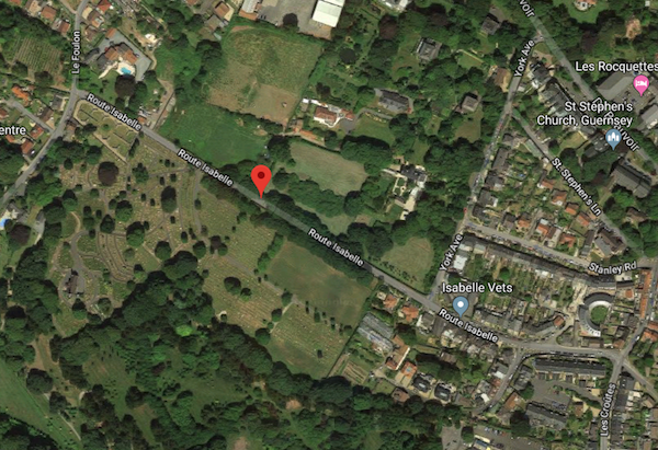
Pictured: Land at Route Isabelle which could now be built on, subject to planning approval
The land at Route Isabelle which is now subject to an approved draft development framework is within the St Peter Port Main Centre Outer Area and it could lead to up to 11 dwellings being built there.
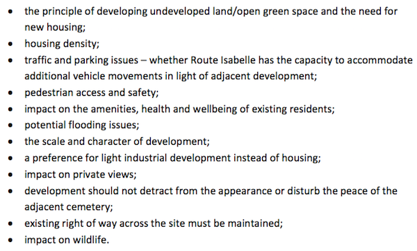
A number of objections were made during a four week public consultation on the plans, but the Development and Planning Authority decided to approve the plans meaning any developers wanting to build there can now apply to do so.

Pictured: Some of the concerns raised during the consultation period on the draft development framework for land at Route Isabelle in St Peter Port
The DPA said all of the concerns raised were "fully considered by the Authority before the final Framework was approved. No amendments were made to the draft framework which has now been published in final form."
The final draft framework can be seen at gov.gg here or at Sir Charles Frossard House.
Comments
Comments on this story express the views of the commentator only, not Bailiwick Publishing. We are unable to guarantee the accuracy of any of those comments.