Select a region


The new 'Better Transport Plan' for the north of Guernsey includes a new concept for the island - a network of roads restricting access to properties only.
That would mean no motorised through traffic would be allowed to use them - but pedestrians and cyclists would still be able to get through.
The scheme has been called 'Ruette des Habitants'.
While it would mainly restrict access to homeowners and their visitors only, there are some cases where access to other properties would be allowed under the scheme.
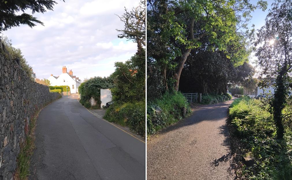
Pictured: Part of Rue des Monts could become a Ruettes des Habitants, restricting access to people with properties on the road, or those visiting the school, preschool, church, or church community rooms.
There aren't currently any Ruette des Habitants in Guernsey - although there are some private and prohibited roads.
The difference between these roads will be explained by Deputies Lindsay de Sausmarez and Adrian Gabriel in an upcoming podcast. Express podcasts can be accessed HERE.
They have led work on the Better Transport Plan as President and Vice President of the Committee for the Environment and Infrastructure.
The Plan was led by the need for more housing to be built in Guernsey, with current development plans indicating more than 1,000 of these could be built in St Sampson's and the Vale over the coming years.
E&I says its Plan will offer more choices for everyone, and that "we can change the way we move around our island, creating a more attractive environment to work and live in and making the journeys better for everyone, even if your choice is to keep travelling the same way as before".
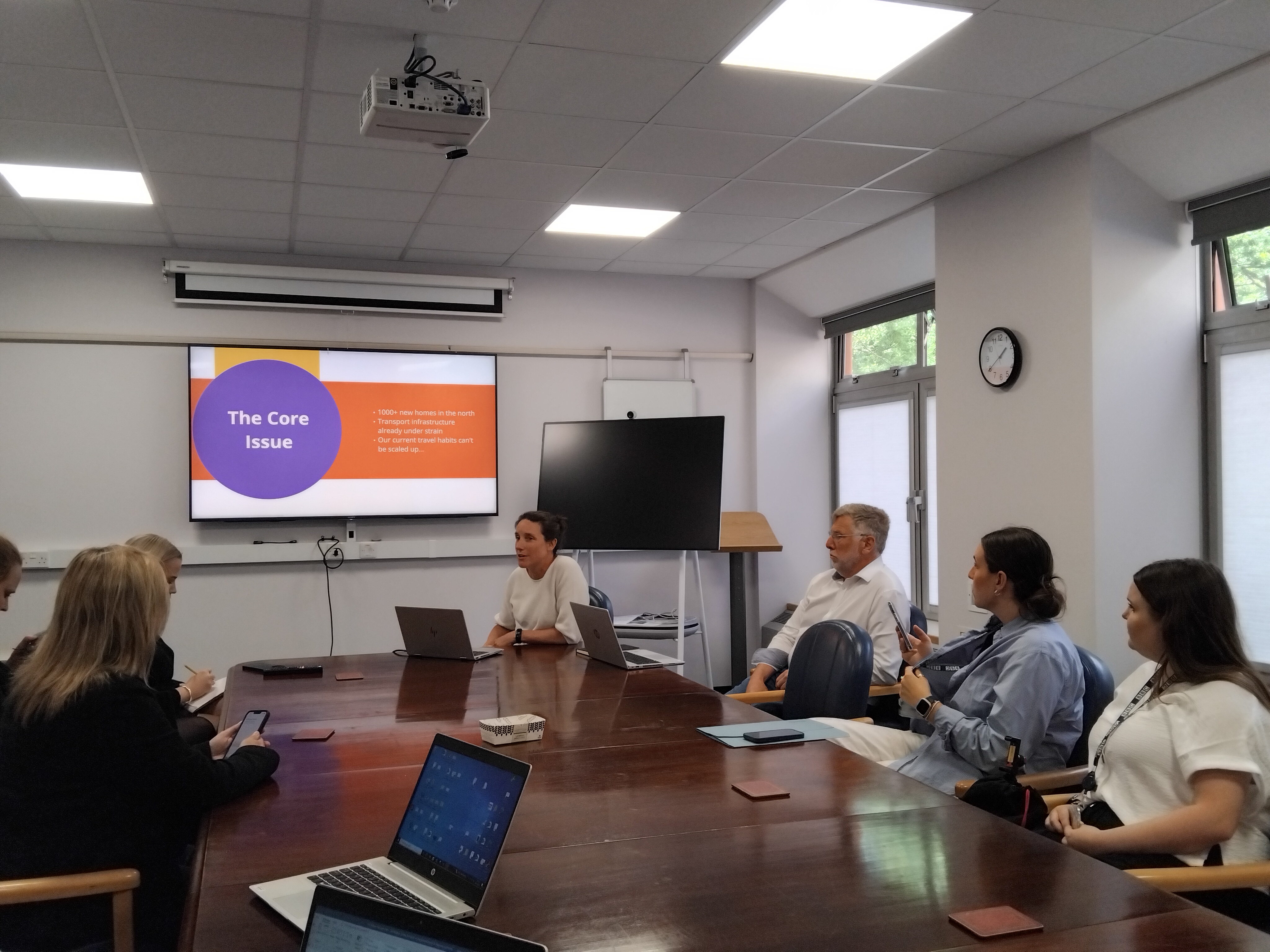
Pictured: Deputies Lindsay de Sausmarez and Adrian Gabriel presenting the Better Transport Plan to the media earlier this week.
The Ruette des Habitants part of the Plan is the designation of a few roads - the majority being near potential housing development sites - for access to properties only.
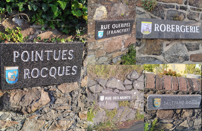
The ones named as Ruettes des Habitants so far are Pointues Rocques, Rue des Monts, Robergerie, the Saltpans, and Duveaux Lane.
Some of the roads will become Ruettes des Habitants entirely while others will only be restricted in sections.
The majority of the Ruettes des Habitants are near one another, and many are near Delancey Park.
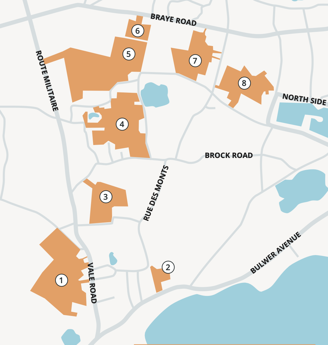
Pictured: Many of the proposed Ruettes des Habitants are near to proposed development sites.
Pointues Rocques could be made a Ruettes des Habitants entirely in anticipation of the creation of 68 new homes on the vinery site to the north of the road.
At one end, Pointues Rocques meets St Clair Hill while at the other it joins Rue des Monts - which would become a Ruettes des Habitants between Mont Morin and Brock Road.
Rue des Monts is home to a few houses, plus a primary school, church, pre-school, and other community groups in the church rooms. The Ruettes des Habitants status would allow access to those properties as well as residential units in the road.
At the other end of Rue des Monts, Robergerie could be designated a Ruettes des Habitants between the junctions with Rue Queripel and Rue Jacques, while the Saltpans will also be a Ruettes des Habitants between those junctions at the other end of those roads.
Pictured: Pointues Rocques (l) and Robergerie (r) could both be restricted to homeowners only under the Ruettes des Habitants scheme.
Robergerie and Pointues Rocques both border the Pointues Rocques vinery development site pictured above (3) with future access to the proposed development being through a property currently on Robergerie.
A short distance away from these roads is Duveaux Lane, which is nearer St Sampson's High School and is currently a two-way road almost entirely surrounded by a network of one way roads.
The Plan suggests making Duveaux Lane a Ruettes des Habitants too along with other changes in that area which we'll explore later this week.
Express asked deputies de Sausmarez and Gabriel about the expected impact of the Ruettes des Habitants scheme on surrounding roads.
They both said that evidence suggests the traffic will not be displaced on to nearby roads and that it would dissipate entirely.
Some current road users may make alternative plans to walk or cycle while others will find alternative routes.
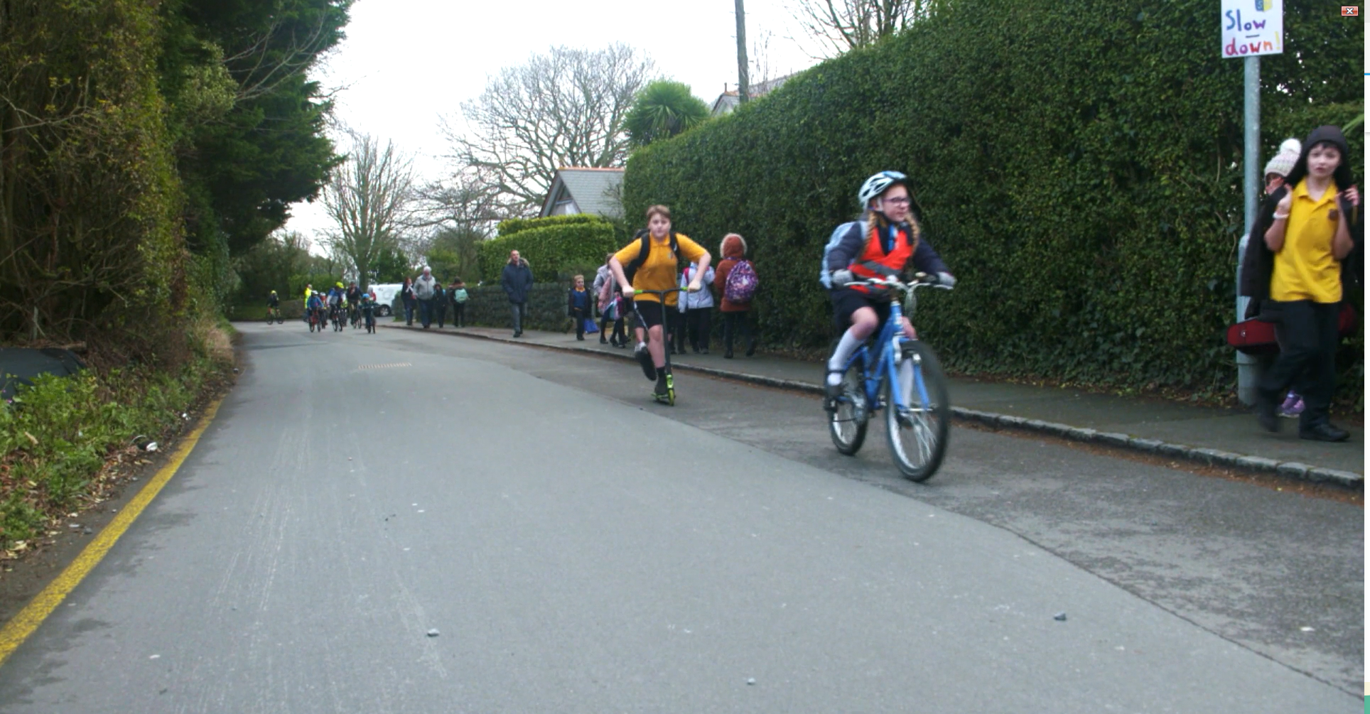
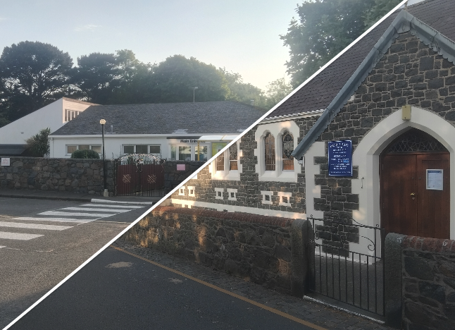
Pictured: St Martin's Primary School has a 'School Street' (image from the Health Improvement Commission).
A comparison was made with the St Martin's School Street which sees the road nearest the parish primary school restricted to pedestrians and cyclists, and property owners directly on the affected road, only between set times around school drop off and pick up times.
Deputy de Sausmarez said rather than other roads nearby becoming busier with an increased number of cars using them, there's actually been a reduction in traffic in the surrounding area too.
She expects the same to happen if the Ruettes des Habitants are approved in the north of the island.
Deputies de Sausamarez and Gabriel will explain further in an Express podcast this week.
Pictured top: These roads could all become Ruettes des Habitants.
WATCH: Transport plan for the north launched
E&I: Plan will "improve choices and experience"


Comments
Comments on this story express the views of the commentator only, not Bailiwick Publishing. We are unable to guarantee the accuracy of any of those comments.