Select a region


The Guernsey Weather Enthusiasts are expecting wintry showers - and possibly more - this evening and into tomorrow.
The Facebook page run by a group of amateur weather watchers has been forecasting a drop in temperatures during January and the chance of wintry showers since late last year.
The anonymous team members are now enjoying "a day of radar watching" while expecting wintry showers later on today.
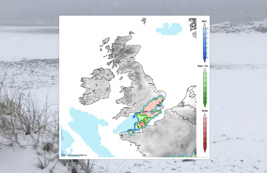
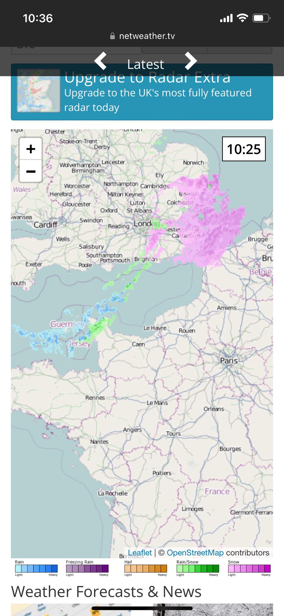
Pictured: The netweather.tv charts predict some form of snow over the English Channel later today and into tomorrow.
"I think our best prospects for any wintry stuff is from this evening to the early hours of tomorrow," the Enthusiasts told Express this morning.
"There’s a cold batch of air moving out of the North East France, Belgium area across the Channel which will hopefully turn the rain showers we’re seeing now into wintry showers.
"...definitely a day of radar watching to see how much and how heavy. As for the rest of the week I think it’ll be mainly cold and dry with sunny spells. No sign of rain thankfully!"
The Guernsey Weather Enthusiasts predict the coldest day of this week should be tomorrow at around 2°C or 3°C with temperatures sticking at 3°C during the middle part of this week.
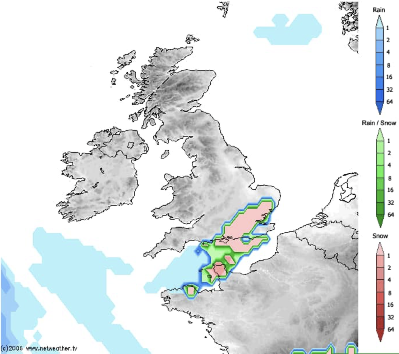
Pictured: The data charts that Guernsey Weather Enthusiasts were looking at earlier today.
The Guernsey Weather Enthusiasts forecast is very similar to the official information published by Guernsey Met today.
While the weather enthusiasts use a number of different sources to monitor local weather patterns, Guernsey Met use official channels and data collection tools.
The forecast for today is for "occasional showers, perhaps wintry", while tomorrow's forecast predicts "cloudy, with a little sleet or snow likely" followed by some bright spells indicating that any wintry showers will be short lived.
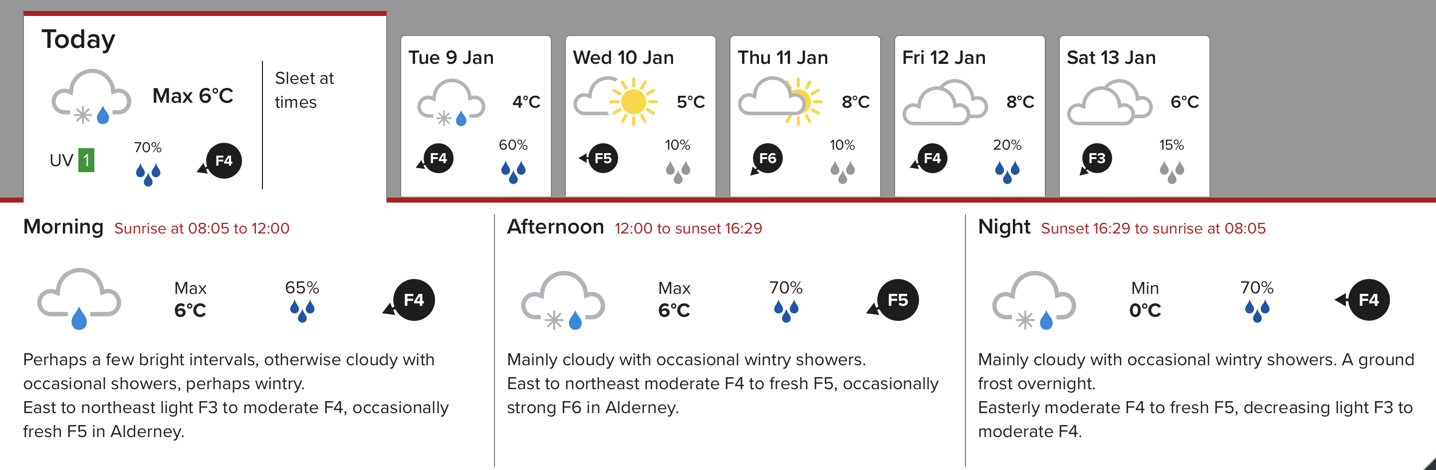
Pictured: The Guernsey Met Office forecast for this week.
The Bailiwick has previously had significant snow fall in the early weeks of the year when temperatures drop to their lowest.
In 2013 the islands experienced the heaviest snow fall recorded in 16 years with three days of snow fall, with the white stuff remaining thick on the ground in some areas for a further five days.
In 2018 schools and businesses closed when heavy snow fall hit the Bailiwick again.
Lesser instances of snow have been recorded since then.
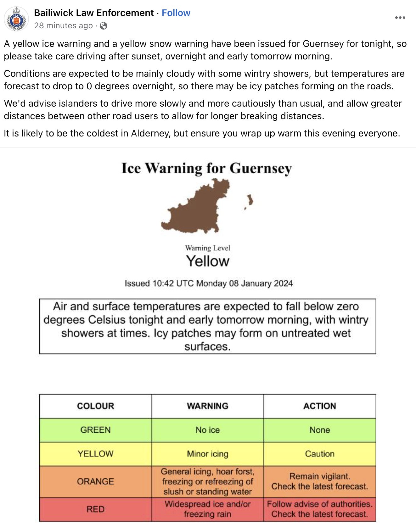
Bailiwick Law Enforcement has published the following update on Facebook:
States update snow plan, ahead of cold snap
Coldest morning recorded in 20 years +
Children, ponies and dogs enjoy the snow....with more forecast ...
Widespread disruption expected with more snow on the way


Comments
Comments on this story express the views of the commentator only, not Bailiwick Publishing. We are unable to guarantee the accuracy of any of those comments.