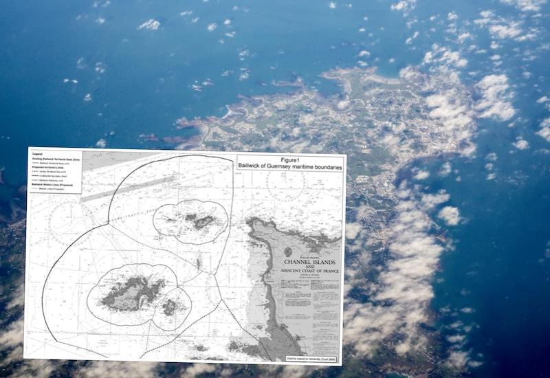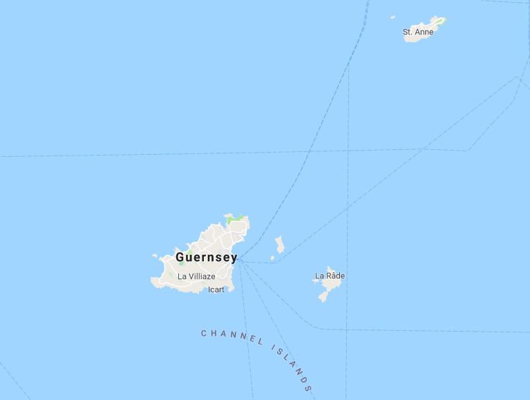

Next Tuesday, the Bailiwick's territorial seas will increase in size, giving the islands more rights, and control over their larger areas.
The move will also bring Guernsey, Sark and Alderney in line with international normals for the extent of territorial seas.
The current limit of the Bailiwick’s territorial seas is three nautical miles (nm) from the baselines. Following decisions in each of the islands earlier this year to request extension of the territorial seas, the new limit will be 12 nm, which is the maximum extent now permissible under the international law of the sea.

Deputy Al Brouard.
Deputy Al Brouard, Policy & Resources Committee member on the Bailwiick Council, said: "I am delighted that Guernsey will extend its territorial sea next week, together with Alderney and Sark. Our islands have been working closely together to achieve this, including through the Bailiwick Council. This joint approach has enabled us to claim the marine area to the maximum limit permitted by the international law of the sea, bringing us in line with international norms and giving us more control over activities there.
"I believe the extension of Guernsey’s territorial sea is a significant step on a journey to ensure that the status of the seas around our shores reflects both our proud maritime history and our developing international identity."

The extension of the territorial seas will ensure that there is clarity about the status of the waters adjacent to the islands of the Bailiwick, which is particularly important as the UK exits the EU.
The extension of the territorial seas gives the three jurisdictions of the Bailiwick greater control over activities in the 3-12nm area as they will have legislative competence and corresponding law enforcement powers in their corresponding area. It brings the Bailiwick in line with international norms, and gives it the same breadth of territorial seas as the UK, Jersey and the Isle of Man.
It will not increase the number and type of responsibilities but it will, self-evidently, mean that a larger area has to be managed by the Bailiwick’s authorities. Existing search and rescue regional operational arrangements and existing pollution incident plans are unaffected by the expansion of the territorial seas.

A territorial sea is a belt or band of sea around a coastal state. The state has sovereignty (including the right to legislate) over that area of sea. However, foreign vessels have the right of innocent passage through any territorial sea. The maximum breadth of any territorial sea is 12 nm from the baseline.
In general, there is an automatic extension of applicable Bailiwick legislation to the 12 nm limit, with the exception of some fishing legislation. Fishing access in the waters around the Bailiwick, from 0 to 12 nautical miles, will remain unchanged on the date of extension. TheUK’s participation in the London Fisheries Convention (or ‘LFC’) will continue until the UKceases to be a Member State of the European Union. The Bailiwick fisheries management regime will also remain the same as it was before extension until any new regime is subsequently agreed between the Bailiwick authorities.
Conseiller Peter La Trobe-Bateman, Chairman of the Policy & Finance Committee, Sark, said: "The expansion of the area of Sark’s territorial sea is a significant development which gives us more rights and control over the marine environment adjacent to us. We, together with Guernsey and Alderney, recognise, value and respect the sea and the opportunities provided by its natural resources."
Pictured top: a map of the new sea territories.
Comments
Comments on this story express the views of the commentator only, not Bailiwick Publishing. We are unable to guarantee the accuracy of any of those comments.