Select a region


A draft framework for a potential residential development off Pitronnerie Road is now open for public consultation, however there are already many concerns about the site's suitability for up to 88 new properties.
The Development & Planning Authority is inviting comments on the draft Development Framework for an estimate of 48-88 dwellings that could be situated in the vacant site opposite the Pitronnerie Road Industrial Estate.
The 1.6 hectare site is currently undeveloped, containing only one small build to the north. Planning argues that the site is "well connected to the wider road network which provides easy access to the Bridge and Town centres."
Development is expected to include a variety of building types, such as detached, semi-detached or terraced houses and flats, expected to be 2-3 storeys in height, depending on the detailed design.
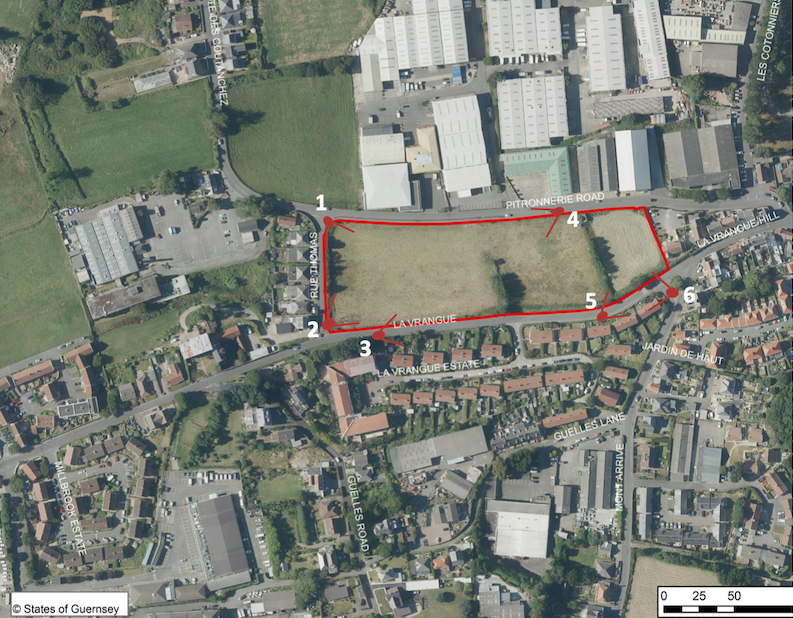
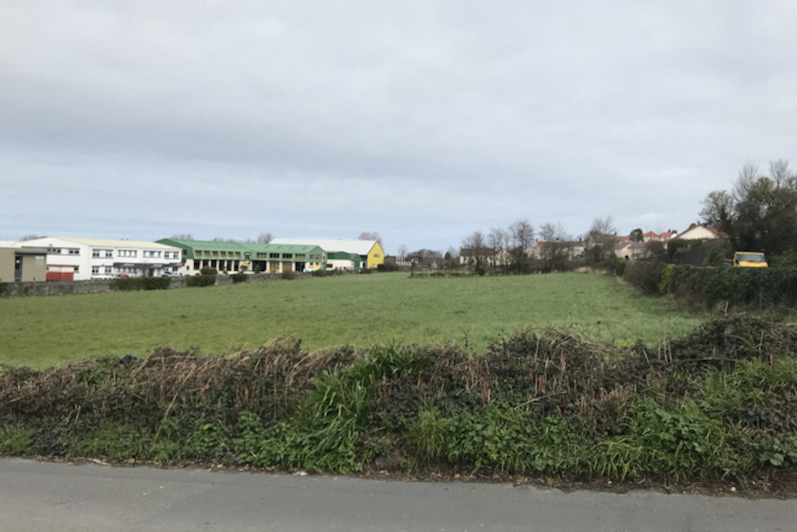
Pictured: The site is bordered by Pitronnerie Road to the north, La Vrangue to the south and Rue Thomas to the west.
The layout and appearance of any houses built will need to ensure resident privacy from those using the surrounding roads.
Developers have also been urged that any new builds do not overlook any existing properties near the site.
The site does not lie within an identified 'flood risk area', said the DPA. However during heavy rainfall, there are concerns about the surface water run-off.
"The site slopes down from south to north and has the potential to overload existing surface water drainage to the surrounding area if surface water is not correctly dealt with," the DPA acknowledged.
"Therefore the design and layout of development will be influenced by the requirement to address surface water run-off on site."
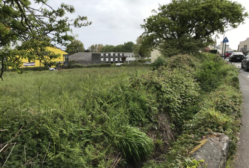
Pictured: Guernsey Water has indicated the need to carry out network modelling to better understand the impact of any future development on the current foul water system in this area.
Once finalised, the framework will provide guidance on how the site could be developed, taking into account site access, impact on roads and biodiversity.
If approved by the Authority, the Development Framework will become Supplementary Planning Guidance and will be noted when considering development proposals for the site.
Comments on the draft Development Framework should be submitted by email to planning@gov.gg or in writing to the Authority over the next four weeks.
All responses, either for or against, should include reasons for why this view is held and should be received by 17:00 on 2 November 2021.


Comments
Comments on this story express the views of the commentator only, not Bailiwick Publishing. We are unable to guarantee the accuracy of any of those comments.