Select a region


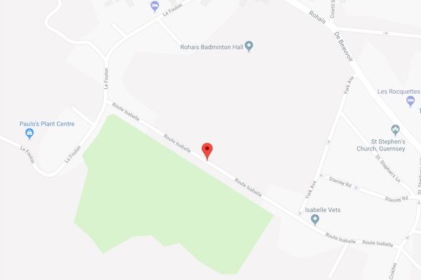
A Draft Development Framework has been prepared by the Planning Service for a potential housing development on land just off Route Isabelle, St Peter Port.
The site is near the junction of the road with Le Foulon, on an area about 2.2 vergees or 0.36 hectares.
The site is inside the St Peter Port Main Centre Outer Area, meaning it is not designated as a Housing Allocation Site and therefore under the Island Development Plan (IDP) policies it could in principle be developed for a range of alternative uses. Although this Development Framework has been prepared with a residential development in mind, it does not "preclude the submission of planning applications for other uses."
The land in question which could be developed is opposite the cemetery and has been used for grazing in the past.
Before a decision is made on whether to develop the land for residential or other purposes, comments are invited. You can read the full draft development framework in person at Sir Charles Frossard House or online at gov.gg. You can comment by emailing planning@gov.gg or by writing to the Authority at Sir Charles Frossard House, La Charroterie, St Peter Port, by Friday 13 April.
Previous Development Frameworks have been approved for residential developments, most recently the Cleveleys Vinery site on Braye Road in the Vale.


Comments
Comments on this story express the views of the commentator only, not Bailiwick Publishing. We are unable to guarantee the accuracy of any of those comments.